Verified views
What is an AVR? The levels of accuracy, explained
Not every verified view needs to be a full photoreal render. AVRs come in escalating levels of accuracy — and matching the level to the question saves time and money.
4 min read
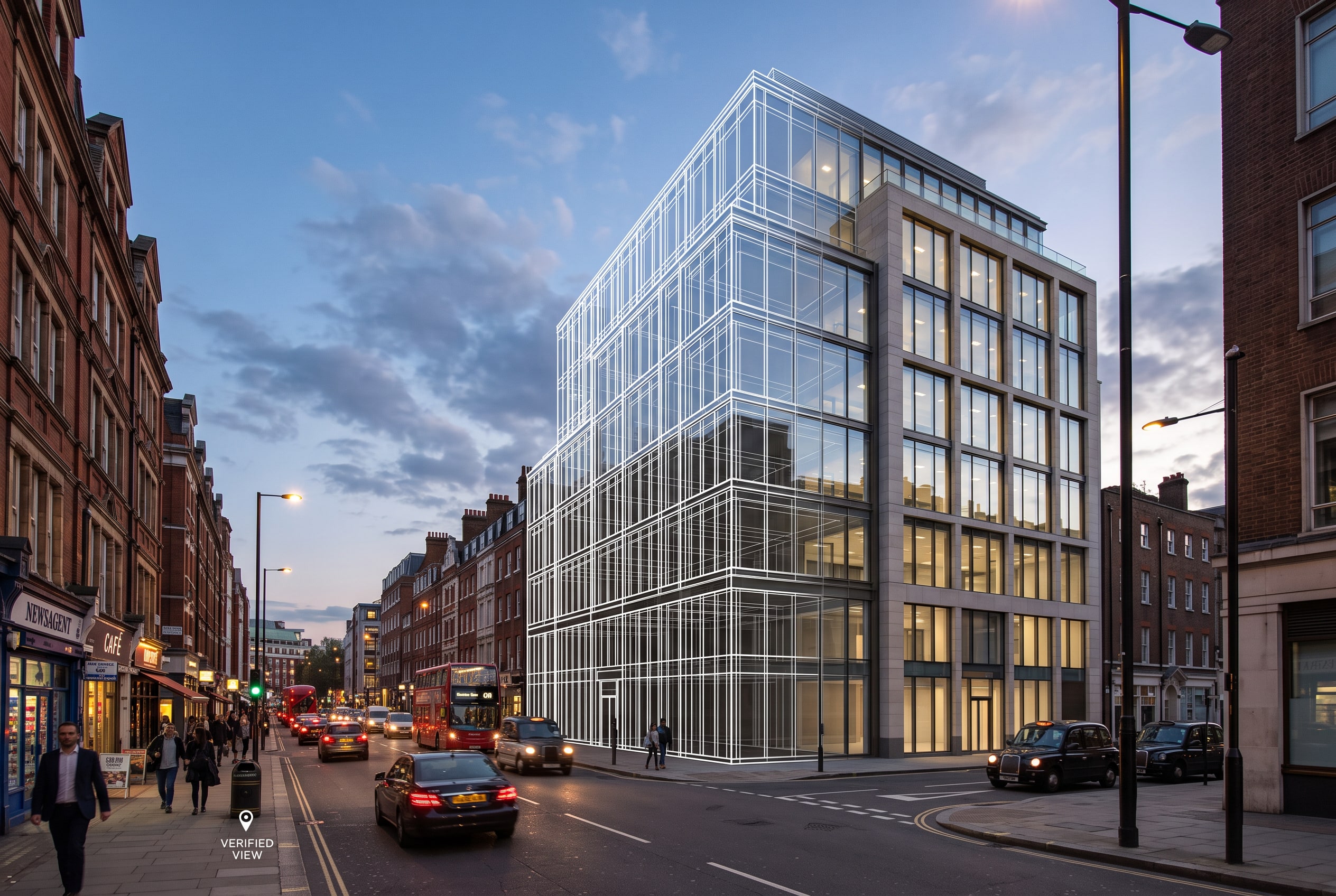
AVR stands for Accurate Visual Representation. The term, and the methodology behind it, come from the Landscape Institute's guidance (TGN 06/19) on visualising development proposals. The key idea is that accuracy comes in levels: an AVR does not have to be a finished, textured render to be useful — it has to be accurate to the degree the question requires.
From wireline to full render
At the simplest level, an AVR establishes only the correct location and size of a proposal in a real view — often shown as a wireline outline over a site photograph. That is enough to answer "how big, and where".
At the next level, the representation also shows how much of the proposal would actually be visible, accounting for what sits in front of it. Higher levels add an accurate description of the massing and scale, and — at the fullest level — the materiality and architectural form, rendered so the building reads as it would be built.
Why the level matters
A fully rendered AVR is more persuasive, but it is also more expensive and, crucially, invites scrutiny of every material and lighting decision. For some viewpoints a wireline is not only cheaper but more defensible, because there is less in the image to argue about. A good verified-view package often mixes levels across its viewpoints, using the fuller treatment only where it earns its place.
Whichever level is used, the accompanying methodology statement records how the image was made — which is what separates an AVR from an ordinary render.